Features Basel Stadtplan
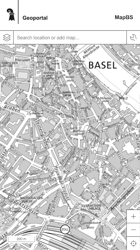
The Basel city map shows not only the official map of the Canton of Basel-Stadt, many other current and accurate geospatial data, maps and geographic information of the cantonal administration.
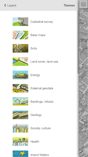
The map viewer includes over 25 different themes with a total of more than 100 selectable levels.
The mobile version includes a slightly lower content of the standard version.
The standard version can be used under map.geo.bs.ch free.The application allows you to find addresses or land, the presentation of interesting places and the use of various additional information (distance measurement, etc.) A switchable GPS function makes finding ones own position on the map.Requires Internet access
Fitness Tracking
Track your workouts and monitor your health metrics.
Travel Features
Plan and manage your travels with ease.
Personalization
Customize the app to match your preferences and workflow.
See the Basel Stadtplan in Action
Get the App Today
Available for Android 8.0 and above